
SR-9/Zion-Mt. Carmel Highway (ZMCH) Construction Alert
Zion Area Road Restrictions
Be Ready for RV and Other Large Vehicle Restrictions
If you’re driving a large vehicle to Zion National Park, make sure you know how to navigate around the Zion-Mount Carmel Highway and Tunnel.
Zion-Mount Carmel Highway
What's Changing?
Starting June 7, 2026, vehicles that exceed any of the size or weight limits outlined below will not be permitted to drive the Zion-Mt. Carmel Highway.
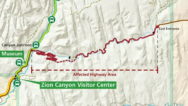
The Zion-Mt. Carmel Highway from Canyon Junction to the East Entrance, not just the Zion-Mt. Carmel Tunnel, has strict vehicle restrictions on all large vehicles. Make sure you understand the tunnel and highway requirements as you plan your trip. You may need to add extra drive time, adjust your itinerary, or change your mode of transportation.
Vehicle Size Limits
Vehicles cannot exceed any of the following measurements:
- Height: Vehicles over 11 feet 4 inches tall (3.45 meters)
- Length: Single vehicles over 35 feet 9 inches feet long (10.9 meters)
- Width: Vehicles over 7 feet 10 inches (2.39 meters)
- Weight: Vehicles weighing more than 50,000 pounds (22,680 kilograms)
- Vehicles and Trailers Length: 50 feet long (15.24 meters), with hitch to rear axle no more than 26 feet (7.92 meters)
Restrictions also apply to:
- Semi-trucks
- Vehicles carrying hazardous materials
- Bicyclists
- Pedestrians
More Information

Height
Restricted for all vehicles 11 feet 4 inches (2.4 meters) in height and over.
Measurements include tires, and attachments such as AC units, bike racks, satellite dishes, or other after-market modifications.

Width
Restricted for all vehicles 7 feet 10 inches (2.4 meters) in width and over.
Measurements include mirrors, tires, and bike racks, or other after-market modifications.

Single Vehicle Length
Restricted for single vehicles 35 feet 9 inches (10.9 meters) in length and over.
Measurements include tires, and attachments such as AC units, bike racks, satellite dishes, or other after-market modifications.

Weight
Restricted for all vehicles 50,000 pounds (22,680 kilograms) in weight and over.

Vehicles and Trailers Length
Restricted for vehicles with trailers 50 feet (15.24 meters) in length and over. The trailer length can not exceed 26 feet (7.92 meters) from the hitch to the rear axle.
Vehicles with trailers, or a combined vehicle, is any motor vehicle configuration made up of two or more separate units that are physically connected at a pivot point and operate together (for example, a truck with a trailer).

Other Restrictions
Pedestrians and bicycles are NOT permitted inside Zion-Mt. Carmel Tunnel. Additionally, semi-trucks and vehicles carrying hazardous waste are not permitted.
Can RVs Still Visit Zion National Park?
Recreational vehicles (RVs) under the size limits may use the Zion-Mt. Carmel Highway. If an RV exceeds the size limits, visitors can still access Zion through the South Entrance, where parking and camping options are available; however, parking often fills early and camping requires a reservation. RVs exceeding size limits will not be permitted past Canyon Junction when entering through the South Entrance.
Learn More
Alternate Routes for Large Vehicles
Vehicles that cannot travel along the Zion-Mount Carmel Highway due to the large vehicle restrictions have options to explore both sides of the park and surrounding areas. Large vehicles are able to access the Grand Canyon’s North Rim Visitor Center and Bryce Canyon.
Paved Routes - North of Zion
North of Zion National Park, you can take I-15 north from Anderson Junction to SR-20, travel on SR-20 to US-89, and then south on US-89. This is a convenient route for adding a stop at Bryce Canyon National Park or Cedar City.
- Distance: 161 miles
- Drive Time: ~ 2.5 to 3 hours from Zion’s south entrance to the east entrance
- Road Condition: Paved highway
NOTE: Travelers on this route may be directed by map and navigation apps to use SR-14 or SR-143. These roads contain sharp curves and steep grades and are not recommended as alternate routes for large vehicles.
Paved Routes - South of Zion
South of Zion National Park, you can take SR-59 east of Hurricane, then continue on Arizona SR-389 and US-89 to reach the east side of SR-9. This route is convenient for adding stops in Kanab or the North Rim of Grand Canyon National Park.
- Distance: 80 miles
- Drive Time: ~ 1.5 to 2 hours from Zion’s south entrance to the east entrance
- Road Condition: Paved highway
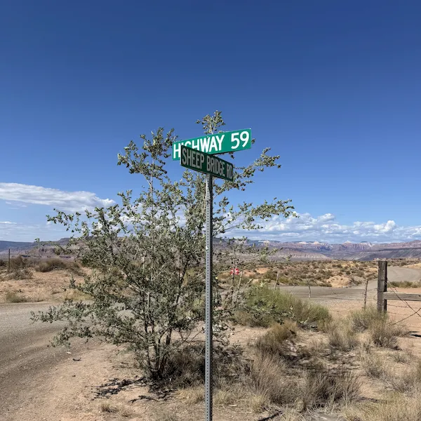
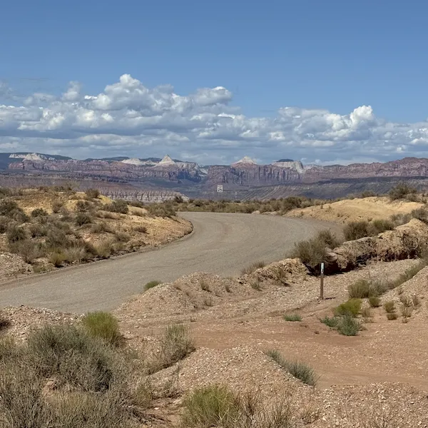
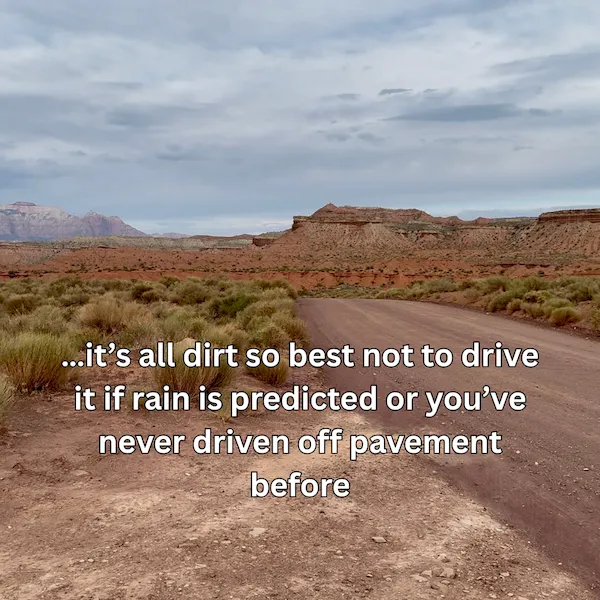
NOTE: Travelers on this route may be directed by map and navigation apps to use Sheep Bridge Road, which connects SR-59 east of Hurricane and SR-9 in Virgin. This is a dirt road and is not recommended as an alternate route for large vehicles or drivers not comfortable with driving off pavement.
Additional Roads in the Area - Caution Advised
Maps and navigation apps may also show additional roads in the area. These routes are not recommended as alternates and travelers should use caution when considering use.
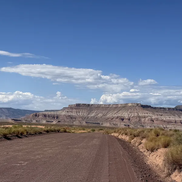
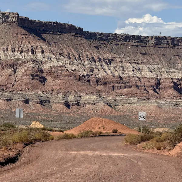
Smithsonian Butte Road
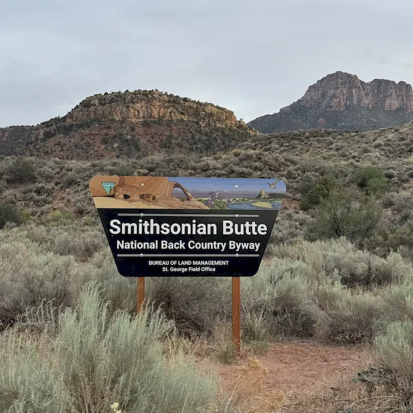
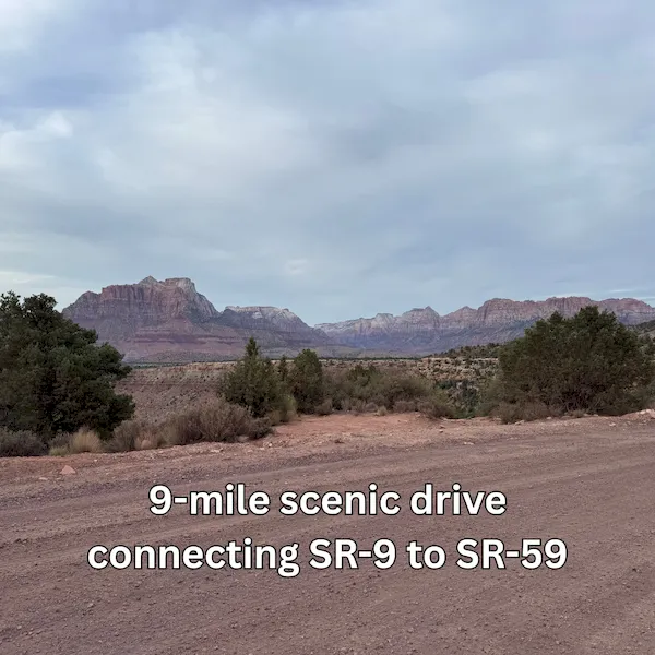
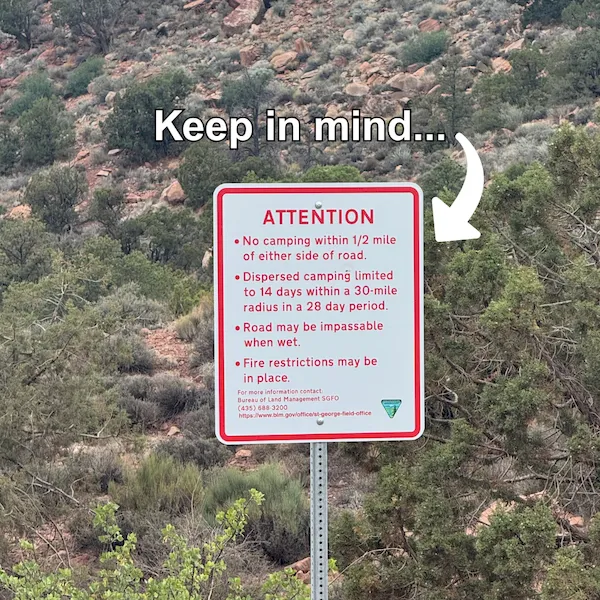
NOTE: Smithsonian Butte Road and Bench Road connect SR-9 in Rockville and SR-59 in Apple Valley. These are rough dirt roads that can become impassable when wet and are not recommended for drivers who aren’t comfortable off-roading. Large vehicles and low-clearance vehicles should avoid this route.
Road Condition: Unpaved dirt road, 1000-foot elevation change with steep sections