Zion Area Road Restrictions
BE READY FOR RV DRIVING
ZION-MOUNT CARMEL TUNNEL
WHAT'S CHANGING?
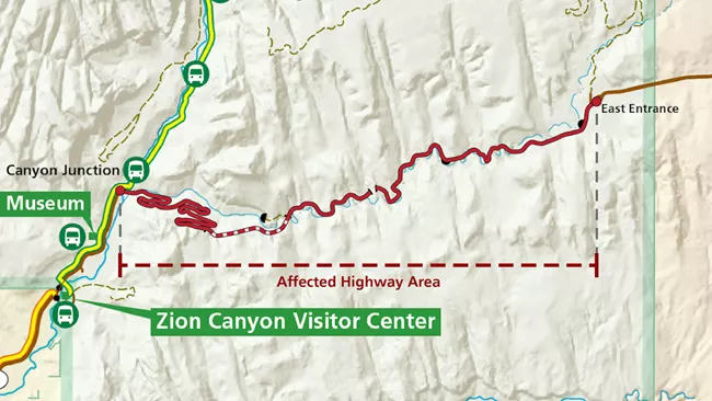
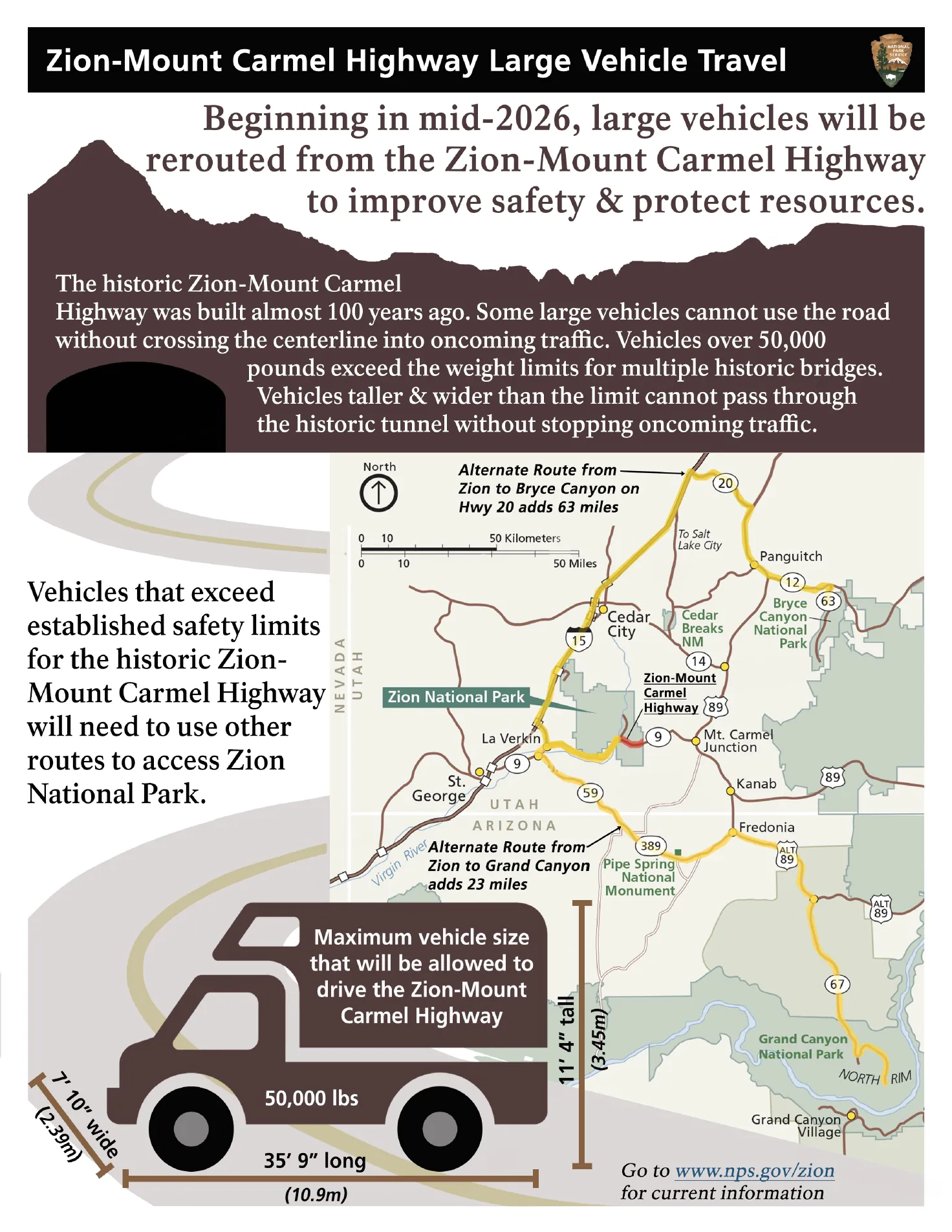
Starting June 7, 2026, vehicles that exceed any of the size or weight limits outlined below will not be permitted to drive the Zion-Mt. Carmel Highway between Canyon Junction and the East Entrance.
Please note: These restrictions apply to the entire section of highway between Canyon Junction and the East Entrance, not just the Zion-Mt. Carmel Tunnel.
The Zion-Mt. Carmel Highway from Canyon Junction to East Entrance has strict vehicle restrictions on all oversize vehicles. Make sure you understand the tunnel and highway requirements as you plan your trip, as you could be required to add significant extra drive time, adjust your itinerary, or change your mode of transportation.
CURRENT RESTRICTIONS
Depending on the size of your vehicle, you may not be able to travel along the Zion-Mount Carmel Highway on SR-9 between Zion National Park’s Canyon Junction and East Entrance. The following are currently prohibited in the tunnel:
- Vehicles over 13 feet 1 inch tall (4.2 meters)
- Semi-trucks
- Vehicles carrying hazardous materials
- Vehicles weighing more than 50,000 pounds (22,680 kilograms)
- Single vehicles over 40 feet long (12.2 meters)
- Vehicles and trailers with combined length over 50 feet (15.5 meters)
- Bicyclists
- Pedestrians
Any vehicle that is 7 feet 10 inches (2.4 meters) in width and/or 11 feet 4 inches (3.4 meters) in height is currently required to have a tunnel permit. This $15 permit allows two trips through the tunnel between the hours of 8 a.m. to 4:30 p.m., when rangers are present to control traffic.
For all vehicles, obey all traffic directions from rangers and slow down while driving through the tunnel. Do not stop or turn around until you pass the kiosk on the other side.
NEW RESTRICTIONS COMING JUNE 2026
CAN RVS STILL VISIT ZION?
RVs that meet the limits may transit the ZMCH. If an RV exceeds limits, visitors can still access Zion through the South Entrance, where parking and camping options are available (as conditions allow). However, RVs exceeding limits will not be permitted past Canyon Junction.
Alternate routes
Paved Routes - South of Zion
South of Zion National Park, you can take SR-59 east of Hurricane, then continue on Arizona SR-389 and US-89 to reach the east side of SR-9. This route is convenient for adding stops in Kanab or the North Rim of Grand Canyon National Park.
- Distance: 80 miles
- Drive Time: ~ 1.5 - 2 hours between the two entrances
- Road Condition: Paved highway
NOTE: Travelers on this route may be directed by map and navigation apps to use Sheep Bridge Road, which connects SR-59 east of Hurricane and SR-9 in Virgin. This is a dirt road and is not recommended as an alternate route for large vehicles or drivers not comfortable with driving off pavement.
Paved Routes - North of Zion
North of Zion National Park, you can take I-15 north from Anderson Junction to SR-20, and then from SR-20 head south on US-89. This is a convenient route for adding a stop at Bryce Canyon National Park or Cedar City.
- Distance: 161 miles
- Drive Time: ~ 2.5 - 3 hours between Zion’s west and east entrances
- Road Condition: Paved highway
NOTE: Travelers on this route may be directed by map and navigation apps to use SR-14 or SR-143. These roads contain sharp curves and steep grades and are not recommended as alternate routes for large vehicles.
Unpaved Routes - Sheep Bridge Road
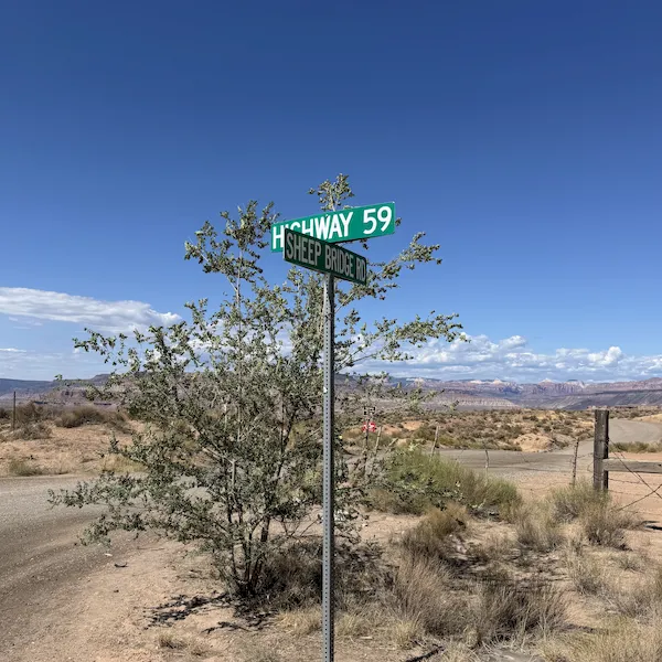
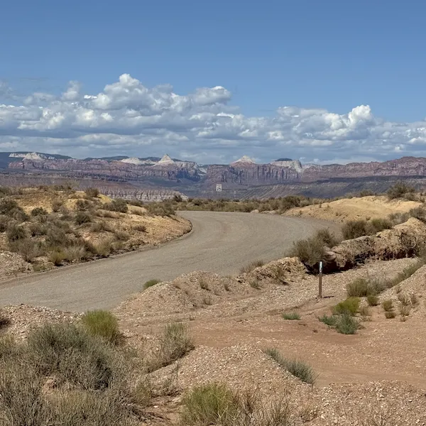
Sheep Bridge Road connects SR-59 east of Hurricane and SR-9 in Virgin. This is a dirt road through BLM land and is not recommended as an alternate route for large vehicles.
- Distance: 5.5 miles
- Drive Time: ~15 - 20 minutes
- Road Condition: Unpaved dirt road, 1000-foot elevation change with steep sections
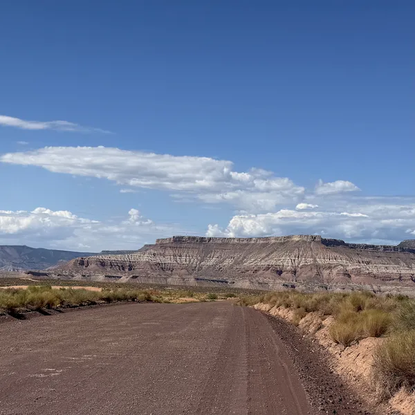
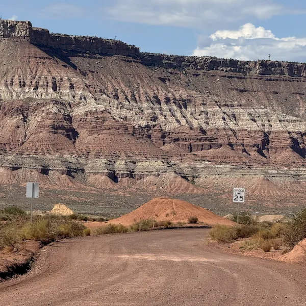
Unpaved Routes - Smithsonian Butte Road
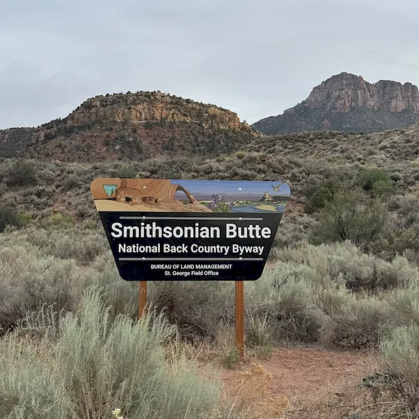
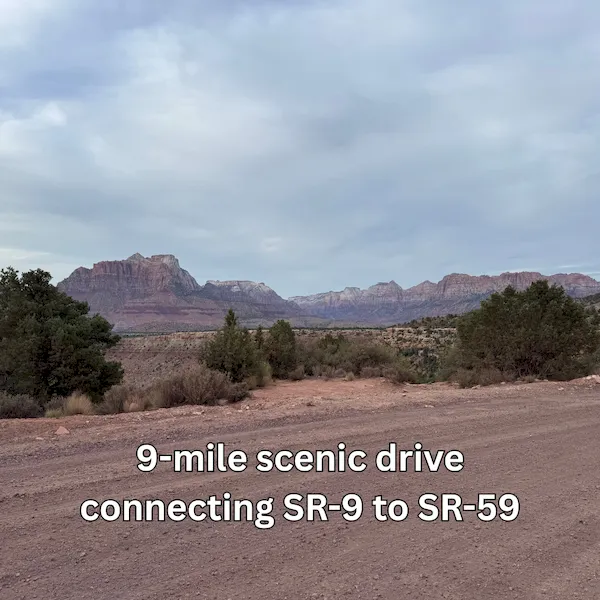
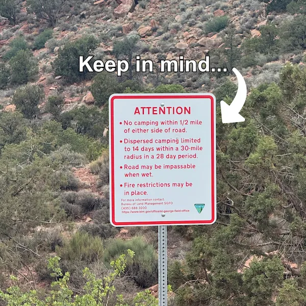
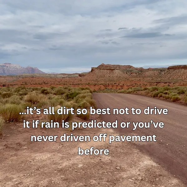
NOTE: Smithsonian Butte Road and Bench Road connect SR-9 in Rockville and SR-59 in Apple Valley. These are rough dirt roads that can become impassable when wet and are not recommended for drivers who aren’t comfortable off-roading. Large vehicles and low-clearance vehicles should avoid this route.
- Distance: 9 miles
- Drive Time: ~ 30 - 45 minutes
- Road Condition: Unpaved dirt road, 1000-foot elevation change with steep sections