Getting to Zion National Park
Plan ahead
TRAFFIC INFORMATION
Road Status Updates
Scroll down for our latest stories and posts. If the space below is blank, there are no new road status updates.
*For the best viewing experience, follow our stories on Instagram.
Traffic Cameras
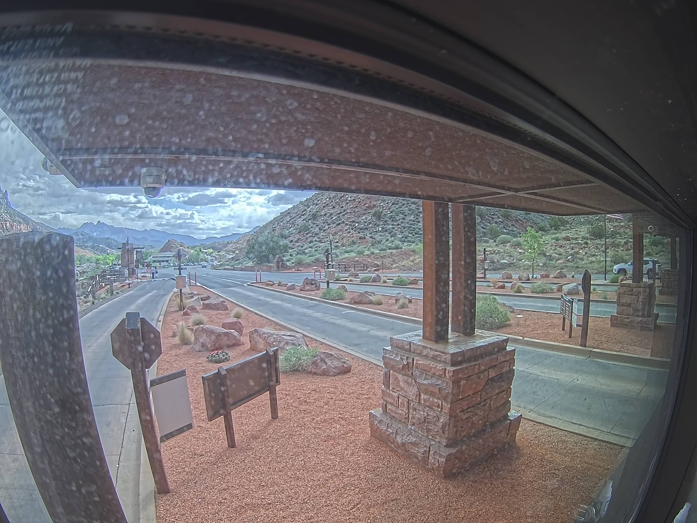
Zion National Park South Entrance
Zion Park Blvd/SR-9 @ 200 S
Zion Park Blvd/SR-9 @ Lion Blvd
Zion Park Blvd/SR-9 @ Quail Ridge Rd
Zion Park Blvd/SR-9 @ 2400 S
State St/SR-9 @ 3700 W/Sand Hollow Rd, Hurricane
State St/SR-9 @ Southern Pkwy/SR-7, Hurricane
State St/SR-9 @ Main St/SR-59, Hurricane
State St/SR-9 @ 500 N/SR-9, La Verkin
Southern Pkwy/SR-7 EB @ Airport Pkwy, St. George
Southern Pkwy/SR-7 @ Sand Hollow Rd, Hurricane
Southern Pkwy/SR-7 @ Sand Hollow Reservoir, Hurricane
Southern Pkwy/SR-7 @ Milepost 21, Hurricane
US-89 @ SR-12, Garfield County
US-89 @ Long Valley Jct/SR-14, Kane County
US-89 @ Milepost 76, Kane County
Center St/US-89 @ Main St, Kanab
I-15 @ Milepost 40, Washington County
I-15 @ Anderson Jct/SR-17, Toquerville
I-15 @ State St/SR-9, Washington
UDOT Road Signs
ZION PARK 45min
SR-9 EB @ Milepost 1, Hurricane
TIME TO CEDAR CITY 36min
TIME TO ZION PARK 49min
I-15 NB @ Milepost 14, Washington
TIME TO ZION PARK 38min
TIME TO LAS VEGAS 1hr 48min
Deer Valley Drive SR-224 NB
before Bonanza Drive
TIME TO ST GEORGE 24min
TIME TO LAS VEGAS 1hr 56min