
SR-9/Zion-Mt. Carmel Highway (ZMCH) Construction
Scenic Byways
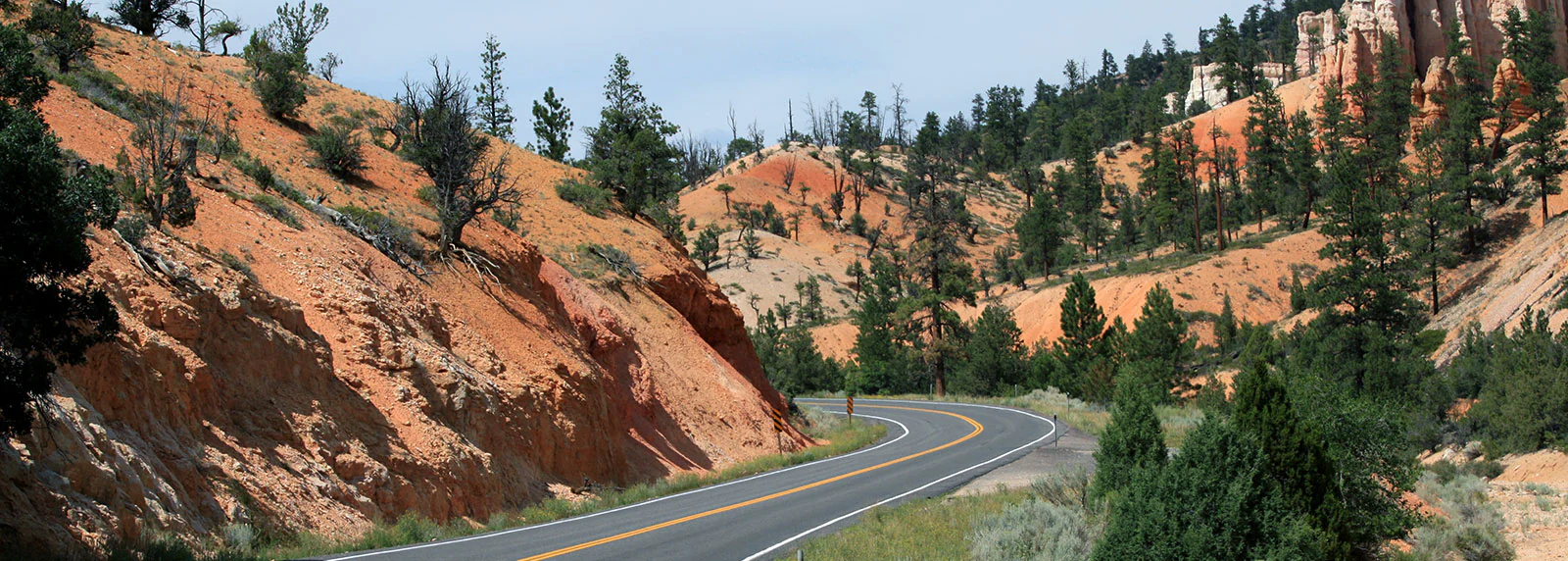
Utah's scenic byways offer unforgettable road trips through stunning landscapes. These designated routes showcase red rock canyons, alpine forests, and sparkling lakes, providing breathtaking views and access to our most beautiful areas. Discover charming towns and hidden gems along the way. From dramatic curves to panoramic vistas, Utah's byways invite you to slow down and savor the beauty.
Scenic Byway Information
Things that could impact your drive:
- Weather (it can change very quickly)
- Traffic
- Wildfires
- Holidays
- Construction
Zion Scenic Byway
This national scenic byway follows SR-9 for 54 miles between the intersection with SR-17 in La Verkin and Zion National Park’s east entrance. The park entrance fee is required to drive through the section in the park even if you’re not stopping. Allow at least one-and-a-half hours for this drive.
Cyclists should expect an uphill ride from La Verkin to Canyon Junction, with some early short climbs, then a long gradual ascent into Springdale and the Zion National Park entrance. Cyclists are NOT allowed to ride through the Zion–Mount Carmel Tunnel. For more information on cycling routes within the park, please visit the National Park Service website.
Cyclists can find more information about bike routes that include the Zion Scenic Byway by visiting the SUBA map of routes and searching for Zion Corridor Trail or Zion Canyon Scenic Road.
- Distance: 21.8 miles (From La Verkin to Canyon Junction Bridge)
- Est. Time: 2 hrs
- Route: SR-9 (paved highway with generally low to moderate traffic)
- Starting Elevation: 3,232 ft | Ending Elevation: 4,035 ft
- Elevation Gain: 1,056 ft | Elevation Loss: 259 ft
- Road Conditions: Mostly smooth highway shoulders; bring lights and bright clothing for visibility
- Services: Available; limited cell service in some areas
Mount Carmel Scenic Byway
This state scenic byway follows US-89 for 60 miles between the intersection of SR-12 near Bryce Canyon National Park and the Utah-Arizona state line in Kanab. This byway is known for its red rock canyons, open valleys, and expansive views of southern Utah's high desert. Motorists should allow an hour for this drive.
Cyclists should expect a net elevation loss of about 1,900 feet, starting near 6,600 feet in Panguitch and ending around 4,800 ft in Kanab. Along the way, you'll climb a total of 1,873 feet, with the highest point around 7,450 feet before a long, steady descent into Kanab.
- Distance: 65.0 miles
- Est. Time: 5 hr 20 min
- Route: US-89 (paved highway with generally low to moderate traffic)
- Starting Elevation: (Panguitch) 7,454 ft | Ending Elevation: (Kanab) 4,839 ft
- Elevation Gain: 1,873 ft | Elevation Loss: 3,776 ft
- Road Conditions: Mostly smooth highway shoulders; bring lights and bright clothing for visibility
- Services: Sparse between towns; carry water and snacks. Limited cell service in some areas
MARKAGUNT HIGH PLATEAU SCENIC BYWAY
This state scenic byway takes you through Cedar Canyon and the Dixie National Forest, following SR-14 for 40 miles between Cedar City and Long Valley Junction at US-89. Allow an hour for this drive.
This byway is considered one of Southern Utah’s premier road cycling climbs and follows parts of the U.S. Bicycle Routes 70 and 79 as well as all of USBR-679. Cyclists should expect a steep early climb with a long ascent through Cedar Canyon into the high plateau of the Dixie National Forest, through dense pine and aspen forests. After topping out near ~9,900 feet, the route rolls and eventually descends toward Long Valley Junction. At high elevation expect thinner air, cooler temperatures, and the possibility of weather changes such as storms or early snow.
- Distance: 40.5 miles
- Est. Time: 4 hr 25 min
- Route: SR-14
- Starting Elevation: (Cedar City) 5,850 ft | Ending Elevation: (Long Valley Junction) 7,620 ft
- Elevation Gain: 4,390 ft | Elevation Loss: 2,779 ft
- Road Conditions: Several extended grades over 8% through Cedar Canyon; traffic can be fast-moving with some narrow shoulders
- Services: Very limited services along SR-14; bring plenty of water and food. Nearest services are in Cedar City (west end) and Duck Creek Village (midpoint).
Kolob Fingers Road Scenic Byway
This state scenic byway is the 5-mile road through the Kolob Canyons section of Zion National Park, off Exit 40 of I-15. Allow 15 minutes each way for this drive. The park entrance fee is required even if you’re not stopping.
Cyclists should expect a short but steep climb with little flat recovery. The route will take you through sandstone cliffs, narrow canyons, and sweeping overlooks — this road is considered one of the most scenic short rides in southern Utah.
- Distance: 5.2 miles
- Est. Time: 53 min
- Route: Kolob Canyon Road (paved, two-lane road with narrow shoulders, light traffic, and some sharp curves)
- Starting Elevation: 5,066 ft | Ending Elevation: 6,234 ft
- Elevation Gain: 1,237 ft | Elevation Loss: 69 ft
- Road Conditions: Grades average 4.5% to 5%, with steeper sections near the end
- Services: Visitor Center only; bring plenty of water and snacks